
- Google has started rolling out an exciting Google Maps feature the company announced back in August.
- Google Maps will now support richer street-level details, with streets that look just like they do in real life, and will offer crosswalk and sidewalk data.
- The revamped maps experience is available in four locations: New York City and San Francisco (USA), Central London (UK), and Central Tokyo (Japan).
Google announced a major Google Maps redesign in mid-August, revealing its intention to offer users more accurate map reproductions. The maps will feature more color to more accurately replicate the actual geography of natural landforms. Included in the update was a handy navigation feature, a faithful depiction of street-level geography. Details like crosswalks, sidewalks, and pedestrian islands would appear on maps, and the streets would look like they do in real life.
At the time, Google said the feature would be available in certain cities, which is understandable. After all, Google has to basically remap entire cities, a process that can take ages. But the feature is finally rolling out in more locations.
The following GIF animation that Android Police shared highlights the changes between the previous version of Google Maps and the updated maps. You’ll notice the crosswalks appearing in the updated map, complete with accurate representations of streets and islands, which feature true-to-scale dimensions and shapes.

The feature is great for pedestrians navigating an unknown city, as it can speed up the entire experience. It’s a lot easier to walk the city from one point of interest to the next if what you see in real life matches what you see on the screen. And the actual position of crosswalks will certainly come in handy, especially when it comes to crowded major intersections.
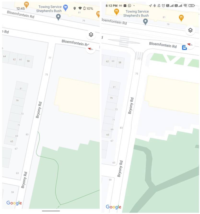
The following comparison shows the same spot in London. On the right, the update shows crosswalks, pedestrian islands, roadside vegetation, and the pathways in the park are clearly marked (dark green).
The feature also has another benefit, helping with accessibility. Wheelchair and stroller access will also be marked on the maps, as will stairs.
Unfortunately, the feature will only be available in a few places, including New York City and San Francisco (USA), Central London (UK), and Central Tokyo (Japan), and there’s no telling when other places will get similar support. But if you’re traveling to any of these cities, you’ll be able to take advantage of the new street-level details. That is, when real life actually returns to some sense of normalcy, and tourism starts picking up again.
You won’t have to do anything to get the new maps experience in Google Maps, as it’s being rolled out as a server-side update, regardless of your Maps version.


